Friday 8 December 2017

Far Eastern Fells part 3

The Shap Fells


1,/9,2017 this mission will explore the valleys along the A6 from Longsleddale to Wet Sleddale, this area is still in the national park of the Lake District but only this year the national park boundaries have been extended and I have one walk planned to take in this new area.
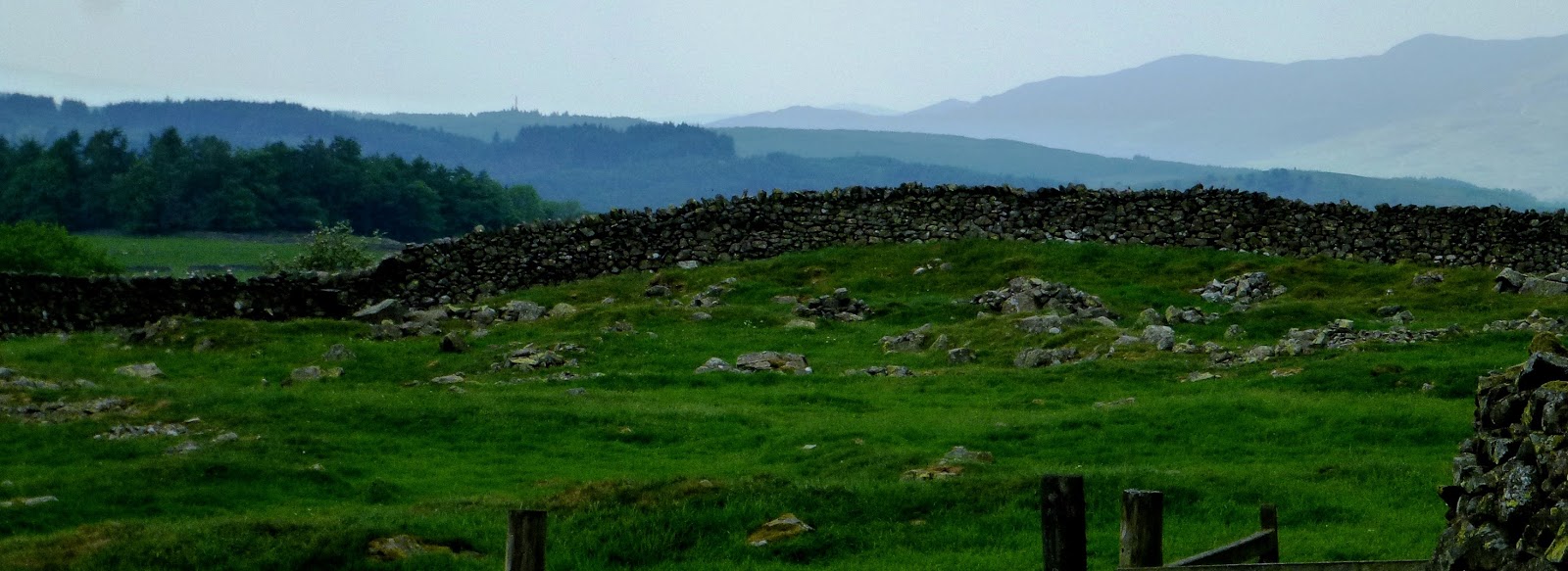
Alfred Wainwright did not class the Shap fells has Lakeland but classed it as the part of the Pennines because the transition of the rocky landscape of Lakeland is sudden and the moorlands of the Pennines starts, this area of upland is covered by grassy fells and heather and bogs, a wild and desolate area with very little rights of way through this landscape and an area what is not explored much by the visitor to Lakeland.

1; Grey Crag
2; Tarn Crag
3; Capplebarrow
4; White Howe
5; Lords Seat
6; Great Yarlside
7; Wasdale Pike
8; Seat Roberts
9; High Weather Howe

A; Longsleddale
B; Bannisdale
C; Borrowdale
D; Crookdale
E; Wasdale
F; Wet Sleddale
G; Swindale
H; Mossedale


The 1st of September and I woke up in the back of the van with my companion Sam the dog and got out to a beautiful sunny morning in Longsledale across from the church, time for breakfast and to start planning my day.

Tarn Crag and Grey Crag

8.45 am I was walking from the church to Sadgill following a bridleway along the valley bottom, at Sadgill I started the steady climb out of the valley passing Buckbarrow Crag, as I left the valley and ground started to level out I came to my first bridge and stopped to have rest and to check the map.
The track splits one going for Gatescarth Pass and the one I want, was the track for Wet Sleddale, I was not on it for long till I reached the fence line what I was going to follow up the hill to Tarn Crag.


I left the fence has the ground started to level out and the sight of a stone pillar came in view, so I walked to the pillar to have a closer look, this unusual pillar is one of the survey pillars erected during the construction of the  Haweswater aqueduct during the 1930's.


Not far from the survey pillar is the summit of Tarn Crag so I head for it, it was from the summit I could see my next destination Grey Crag, I laughed to myself because back in May when I got lost in the low cloud and  I could not find Tarn Crag.

Tarn Crag.

Today with good views I walked to the summit of Grey Crag enjoying the views of the fells I was going to explore over the next few days. From the summit of Grey Crag, it was downhill to head back into the valley of Longsledale and the end of the walk back at the church.

Bannisdale Horseshoe

12 miles, 2/9/17
This walk is a circuit of the valley of Bannisdale and follows the watershed around it crossing large areas of grassy prairies and peat bogs with no rights of way so pathless, and gates to climb and fences. So on a lovely sunny morning, I set off for Moser Farm along a nice track passing the farm till I came open country and my first gate where lifted Sam over and headed for the summit of Whiteside Pike.

Whiteside Pike

Pure blue skies and good views from Whiteside Pike so on I went enjoying this grassy grassland crossing walls and climbing to my next summit of Todd Fell, from Todd Fell you could see down into Longsledale and the fells of Kentmere, from Todd Fell it was the climb to Capplebarrow following the fence line to the top of Capplebarrow and time for a rest.

Capplebarrow

                                                                                                1; Yoke 
                         Capplebarrow
         2; Rainsbarrow Crag
         3; Ill Bell        
         4; Froswick 
         5; Caudale Moor
         6; Thornthwaite Crag
         7; Shipman Knotts
         8; Kentmere Pike
         9; Harter Fell
The weather was still good with plenty of sunshine as I took the views in from Capplebarrow, the next section of the walk was to go around the head of the watershed of Bannisdale  first climb another gate and pick Sam so I could get him over and then carry on following the fence line and an old broken wall with views down into Bannisdale  valley and then pull away from the boundaries and aim for Long Crag


Capplebarrow
I made it to Long Crag and had a nice long dinner break and not seen anyone on this walk till now as I seen another walker in the distance navigating around the headland. It was time to move on and climb to White Howe through more peat bogs and heather to find the trig point of White Howe and that walker who I had seen had now caught up with me and it was a woman we had a brief chat and then I moved on while she rested.

White Howe
I now could see across the valley to Capplebarrow and Todd Fell as I headed for Lamb Pasture and was bypassed by the woman walker, now the last part of the walk took me off the fells and into the valley through trees and sheep pasture to finish off  this walk and what a walk all thanks to having great weather has made it a good walk.

The Whinfell Ridge Walk

This walk came about because this year the Lake District National Park had extended its borders in some areas and one area is Borrowdale, not the Borrowdale of Keswick but another one. Also, the national park was celebrating getting World Heritage Status, so to celebrate this I have  included this walk from Alfred Wainwrights Howgills Fells book that this walk is now in the national park, and was a walk from the A6 across the Whinfell ridge to the M6 and back along the valley of Borrowdale to the finish.
This morning was a damp grey day after my night in the car park at Wet Sleddale, a new weather front had moved in overnight, at least it was not raining so all packed up for a days walking I was back on the A6 and over Shap Summit to a layby in the Borrowdale Valley. Huck's Bridge and parked up.
It was only a short walk along the A6 and we were climbing Ashstead Fell and there was a low cloud over the distant fells as we reached the heather top of Ashstead Fell 455m/1493ft, but still decent views for a grey day.

Ashstead Fell
And now the ridge walk along a faint path to  Mabbin Crag, as I reach the summit of Mabbin Crag 482m/1581ft, and moved through some lovely undulating landscape of heather to reach Castle Fell and then Whinfell Beacon 472m/1549ft, The beacon was in ruins and was once a 15th-century fire beacon. I had a short rest while enjoying the good views. 472m/ 1549ft4.

Whinfell Beacon
Coming off Whinfell Beacon I was stopped by a heard of sheep blocking my exit and two farmers sorting them one by one through a sheep pen, I had good ten minutes of watching this till one farmer let me and Sam through.
Now time to look for a place to have a rest and have lunch. I had come to a road and the telecommunication station and no sign of shelter, I left the road behind and took the path over a wall and found my lunch spot and then it started to rain. 
By the time I had finished my lunch and I was ready to get going again the rain had stopped, so I set off again climbing up to the summit of Greyrigg Forest, the highest point on the walk at 494m/1,621ft at the trig point I reached.

Greyrigg Forest summit looking towards the Howgills Fells
From the summit the last part of the ridge walk was only a short distance away then it was down into the valley, I walked to the end of the ridge known as Greyrigg Pike and there I rested and enjoyed the all-around views, even the sight of the M6 did not spoil it.

Greyrigg Pike
I headed down into the valley with some difficulty because I lost my path and did not find again till I got to the valley bottom and picked the main track up what I was going to use to take me through the length of the Borrowdale valley.

I headed down into the valley with some difficulty because I lost my path and did not find again till I got to the valley bottom and picked the main track up what I was going to use to take me through the length of the Borrowdale valley.
It was only in the valley that day that I passed any others walkers has I followed the track up the valley passing through oak woodlands and then back into open countryside keeping close to the river and passing through a farm and on following the track till I came full circle and reached the A6 again and the end of the walk.


Shap village walk 

Another night in the car park at Wet Sleddale and a night of rain that continued into the morning. So I put off any hill walking today and planned a short history walk around the village of Shap.
So I set off and found a car parking space in the centre of Shap village and then set off on the walk on this damp grey late morning for Skellaw Hill by road out of the village up to a small hill, at the top of this hill and I looked over the wall, there is a small mound, this small mound is all that is left of a huge burial chamber from the late Neolithic or early Bronze Age, an excavation in the 19th Century found human remains and stone tools.

Skellaw Hill
Also of importance, while standing here on this hill with good views of the surrounding area is that this site is linked with by an avenue of stones that leads to a stone circle, Kemp Howe.My mission was to try to find any of these stone that makes up the avenue and then find the stone circle.
Looking at the map of the area there are several stones marked on the map some with names, and the first one I was going to look for was called Thunder Stone.
So I followed the road again till I came to the Thunder Stone no access to it but I could see it in the field this stone like the others I was looking for are erratics left over from the last Ice Age. I moved again to look for another stone, and I found another what was part of a wall now and then in the distance I could see a massive stone this must be the Goggleby Stone.

Goggleby Stone
I reached the Goggleby Stone and it stood about two meters high and I could see Skellaw Hill and another smaller stone aligned between the two marking the line of the avenue.
 As I headed towards the village looking for other stones found another two has I came back into the village and went back to the car and took it up the A6 to the stone circle.

Kemp Howe
And a field next to the railway line was Kemp Howe stone circle or what was left of it because the railway line had cut through it how sad and that was the end of this walk.

Wet Sleddale Horseshoe


Starting from the car park there is a good path along the reservoir after leaving that it is rough grass walking uphill till you come in sight the grouse butts and then you meet a track what takes you to the wooden Lunch House, its here I used the building to shelter against while it rained, the only shower of the day. from the Lunch House, the path deteriorated to bogs and heather as I made my way to the large rock known as the Grey Bull.

Grey Bull
From the Grey Bull and across more bogs and heather I came to Sleddale Pike and then on a compass bearing through heather and bogs on this pathless trudge to Wasdale Pike the only good thing about this walk was the long distant views I was getting as I sat having lunch.
From the pike more bogs and tough grasslands to cross to Great Saddle Crag and was on this summit I disturbed some red deer as they bolted off into the distant. I carried on not enjoying the walk because of hard work involved in crossing this tough landscape to next summit of Ulthwaite Rigg and then more rough walking and joy came I reached the bridleway and it was going to take me back to end of the walk.


So the last hour of this walk was good and relaxing now following the bridleway with good views down the valley to Wet Sleddale Reservoir.

Crookdale Horseshoe

This last walk of this mission is the Crookdale Horseshoe walk and this is also the last piece of the jigsaw for this area. The start of the walk was in a layby on the A6 Shap Summit. It was a cloudy morning as I and Sam out into the moorland following a faint track and a stone wall and working around peat bogs to get to Little Yarlside crossing Wasdale Mouth and then the climb to the summit of Little Yarlside and then another climb to Great Yarlside summit and a rest stop to admire the views back looking across vast areas of grassland and views down to Wet Sleddale.
The next section of the walk was to follow the fence line to Harrop Pike taking in the head of Crookdale, it was easy walking and more grassland and bogs with wide open views all around. 

Harrop Pike
So far I was really enjoying this walk, Wainwright seen this area as drab because of the lack of rocky scenery, but I was enjoying the big sky and the long distant views south and east, I took another break at Harrop Pike.
The views to the higher fells were poor because of the low cloud but I could see Tarn Crag. from Harrop Pike, I set off following another fence line downhill and near the bottom, I skirted away from the fence line to go around Buck Crags and on a compass bearing I headed for Lords Seat and picked up a faint track to the summit. From the summit of Lords Seat, I made my way to the summit of Robin Hood and stopped for a break this summit had a cairn and views into Borrowdale and I could see my last summit of High House Bank.

High House Bank
I made to the summit of High House Bank with good views around and the last part of the walk was down into Crookdale to Hause Foot and the climb to the A6 Shap Summit and back to the car and it's been a great walk.


And the end to another mission to the Lake District and this mission has been good but tough because of the little access there is to the Shap fells and a final word my camera has dust on the lens and has left black smudges on the photos. And my next mission should be a winter mission. 

Monday 14 August 2017

Far Eastern Fells part 2

Kentmere

Bank holiday weekend 2017 and with five days planned for the Lake District, I was off Thursday evening leaving Derbyshire behind and up the M6 motorway just me and my dog Sam we arrived just after nine pm. And the area to be explored this time was the Kentmere valley. I drove up the valley to the village of Kentmere and parked up in front of the church, and as dusk settled in I took Sam for a short walk and then I made my bed up in the back of the van and fell asleep on this warm night.


Kentmere Horseshoe 12 miles.

Yoke, 706 m, Ill Bell, 757 m, Frostwick Fell, 720 m,, Thornthwaite Crag 784 m,, Mardale Ill Bell, 760 m,  Harter Fell, 778 m, Kentmere Pike 730 m, and Shipman Knotts, 587 m.

26th of May. 
With only about six hours sleep I was up early around 5 am because if it was going to be a hot day like the past few days have been, I and Sam did not want to be in the full heat of the sun for this long walk, taking in eight Wainwrights fells that surround the head of the valley.
so all packed up we set off as the sun was just rising over the surrounding hills, we climbed the track known as the Garburn Pass passing a large boulder known as Badger Rock. And as I climbed higher the view of the Kent valley opened up as a walker passed by and stopped for short chat, he was also doing the horseshoe walk but he was also eager to get on with his walk and not stand around and admire the views as I was doing, so he went on.
I left the valley and came to the area I had recognised from my previous mission to Sallows in my last visit in winter.
Now I was on the path to the summit of Yoke and the early morning mist across the landscape was looking wonderful especially to the east,


Yoke

.
The view east

I had reached the summit of Yoke 706 m and had a short break to admire the view and take a few photos 


Yoke
The best view was south to Lake Windermere, but the view I was admiring was my route to the cone shape Ill Bell, so on I went down and then up to the summit of Ill Bell 


Ill Bell.
from Ill Bell looking at Frostwick Fell and Thornthwaite Crag,
Ill Bell and another short rest and then onto Frostwick Fell what is identical to Ill Bell but smaller in size, up and over the summit and the climb to Thornthwaite Crag, The far distant views to the Scarfells and Coniston was hazy so no long distance photos but I did stop for a rest at the summit this was also my turning point.


Kentmere Valley
Thornthwaite Crag commands a position that looks over four valleys, Troutbeck, Kentmere Threshwaite Gill and Hayeswater and also the source of the River Kent
The turning point of the walk was the head of the Kentmere valley with good views down the valley, as I set off again for Mardale Ill Bell.

Thornthwaite Crag
This was also my half way point in my walk, and I soon reached Mardale Ill Bel and passed on with stopping and came to the Nan Bield Pass and the stone shelter with a beautiful view down to Hawswater and small Water from the ridge.


Nan Bield Pass
Now in front of me was the steep rocky climb to Harter Fell, I  arrived at the summit but the heat of the day was getting stronger it was now 11.20 am, I had another rest thinking it was all down hill from this point.

Harter Fell
With views now across the valley to Ill Bell, I made my way to the next summit of Kentmere Pike, this section from Harter Fell was easy walking on grass, from the summit Kentmere Pike I carried on without stopping and started on my way to the last summit Shipman Knotts
At the summit of Shipman Knotts, I was thinking about the walk I had nearly completed and the joy it had given me to do it and in the words of AW 
I found this life enjoyable, up here on the quiet summits, not down there in the crowded streets. Up here, I was able to stand back from a too-familiar environment like a painter before his canvas and view events in true perspective.
Shipman Knotts
the final walk back down into Kentmere valley was good with a great view back over the valley head. It was 15.30 pm and it has taken around six hours to do, back in the valley and the heat was even hotter, but now I was finished back at the church it was rest time.


Orrest Head Part 2, 2 ½ miles.

26th of May
After a lazy afternoon of relaxation I was eager to do something and the weather still hot and sunny this would be a good time to visit Orrest Head again after my last mission was a disappointment because of the weather. so I drove to Windermere and parked up and set off on this small circular walk.and when I got to the view point I had the view I wanted and had the place to myself but not for long as a group of Chinese tourist turned up but I waited them out as they posed for their cameras in groups or just a phone selfie and then they were gone I had no rush I stayed and relaxed once more soaking up the views on this beautiful sunny evening.


Orrest Head

Green Quarter Fell 5 miles.

27th of May.
Next day I was once again in Kentmere and up at the church parked up on another hot sunny morning but not planning to tackle any major fells, but a day of exploration and some easy walking planned. I started the climb out of the village with good views back to the village but what interested me as I climbed higher was the view down to Kentmere Tarn.
What you see today is not the original tarn but one what has been drained to provide better
agriculture land in 1840 and it was found that the lake bed held deposits of diatoms (fossilised aquatic plants).The diatoms were then mined. 


Kentmere Tarn
once out of the valley the landscape flattened out to an area of tussocks grassland; that is grazed by sheep, in the wetter parts Haire's-Tail cotton grass Eriophorum vaginatum L and Bugle Ajuga reptans giving colour to a bleak landscape, with its spike flower of deep blue.

Bugle

 Haire's-Tail cotton grass 
In the distance, I got my first view of Skeggles Water and found a faint path to the shoreline and had a rest there enjoying this sunny morning with no sound but that of the birdsongs,
I retraced my way back to the bridleway and carried on missing out the summit for the great views.into  Longsleddale as I skirted the valley to meet another bridleway coming out of the valley what took me to point of yesterday's walk when I was coming off Shipman Knotts I came this way and again repeated the last part of the walk by following the same path back to Kentmere.


High Knott and the Kentmere Valley 7 miles

27th of May
After an hour of resting, I was out again on my second walk of the day and also there was a difference with the weather with more cloud now.  I passed Kentmere Hall with a 14th century Pele Tower and started the climb out of the valley following the bridleway with good views down the valley.
The Kentmere  Valley has had human occupation going back to 4000  BC  with evidence from the Bronze Age at several sites such as  Hugill site what I was soon to pass by.


Hugill is marked by a low embankment surrounding an irregular pattern of streets. ,


Hugill
I could see rain clouds in the distance and they were heading my way, could I make it to High Knott in time, as I got closer to High Knott I could hear thunder as well but time had run out for me as I got to the bottom of High Knott the storm hit me and me and Sam had to find shelter fast we took shelter under a tree and with our backs up against the wall, the heavy rain came I pulled out the survival bag and covered us up and started listening to the heavy rain hitting us and the sound of thunder as well.
After the storm passed and the rain eased off we headed down the hill to Browfoot and the valley floor with the fresh smell of rain known as petrichor I started the walk back to Kentmere passing the tarn on the way and the end of the walk.


Reston Scar and Hugill Fell 2.5 miles.

28th of May.
After a night in a layby on the edge of Stavely I was ready for another day of walking , it was a damp and over cast this morning, as I climbed Reston Scar nice little fell but because of the low cloud this morning the views were  poor but still a wonderful place as I walked over Reston Scar now heading for Hugill Fell. Back in Alfred Wainwright day you could not do this but had to be done as two separate walks, but today you can, the cloud was slowly lifting as I reached Hugill Fell.
A good part of my outdoor lifestyle is spent studying the sky and reading the signs from it, wind direction to the type of clouds to show the different weather patterns and also there is the beauty of the ever changing sky to lay on one's back and enjoy watching the clouds move by. 
Clouds are the transient of nature's creations. They come out of clear sky, disintegrate before your eyes, vanish. You never see the same cloud twice. Every moment of its brief existence brings a change, of form or tint or texture for us to see every day if we are not too busy to look up....'Alfred Wainwright  
Kentmere Valley
From the summit of Hugill Fell there was a nice view up the Kentmere valley I descended of the fell and down into the valley with the last part of the walk, road walking back into Staveley.


Potter Fell

28th of May
This is the last walk of the Kentmere Valley walks and on a back road between Stavely and Bowston I found a small parking place to start this walk the weather had improved with cloud breaking up and the sun now shining
I had started the walk  and now climbing out of the valley through a bracken and rocky landscape and the views south started to open up as I came to a nameless summit, around me now the views got better as I could see the Fells of the Kentmere valley and has the landscape changed to one of grass and heather as I crossed  the .fell and onto Burnt Knott 
and rested to take in the surrounding views.


From Burnt Knott to an another nameless summit going was not straight forward with only a faint path or just a sheep track if it went in the right direction I followed it through heather and grassland passing through walls to get to Ulgraves summit. From the summit, there were views into Longsleddale.
Now the last part of the walk was down to  Gurnal Dubs reservoir.  not seen anyone on this walk till now and there were few people about relaxing around the reservoir enjoying the afternoon sunshine so I stopped and had a good rest myself.


The last part of the walk was passing Potter Tarn and Ghyll Pool, all three water bodies I have passed all feed into each other and are either man made or modified so they could feed the paper mill in the valley.
And that is it for this walk and the end of my planned walks and I still had a day to spare.


Longsleddale

28th and 29th of May 2017.
The rest of my day and night was spent visiting the valley as far as the church where there is a car park and it was here I stayed and enjoyed a relaxing evening with good weather.


Next morning was a bank holiday and the weather was one of all day raining till mid afternoon and all the surrounding fells were covered in low cloud so when I stepped out form the van at Sadgill, after spending three-quarters of it cooped up I was eager to get some fresh air and exercise so I went and climbed Gray Crag going was fine and  I even found the summit of Grey Crag but from there things went wrong I made three different bearings from the summit,  for Tarn Crag but never made it, timed every thing through the thick fog and two them ended up at another summit called Harrop Pike how bizarre, I even had a brief panic moment of being lost and injured but I soon put a stop to that. I went through all my navigation training and still no luck so I gave up and retraced my way back to Sadgill and out of the cloud still puzzled and that ended my stay in Longsledgedale,


Longsledgedale,

 from there I drove to Kendle and onto Scout Scar for another short stroll to the musroom to end my holiday Next mission Shap Fells in September. 

Thursday 18 May 2017

Far Eastern Fells part 1


Introduction

I am onto my third book from Alfred Wainwright Far Eastern Fells book 2 and as I break the book down  into where I want to start the first mission from the book, I find out it will also include walks from the book The Outlying Fells by AW this book I have been working through also on previous walks.
So it's 2017 and the first mission of the year was going to be in February,  between the towns of Ambleside and Windermere and base camp was to be the Troutbeck valley,
I was planning to go to the Lake District for the 24th of February but storm Doris got the better of me, so I left it till the 26th arriving late Sunday afternoon at Troutbeck and parked up for the day on Green Gate, 
My only companion on these missions is Sam the dog, so we set off on a small walk around Troutbeck village to get my bearings and explore the area. I had planned to stop at Green Gate for the next three nights sleeping in the back of the van. so this evening I got my portable fire out and my supply of logs and had a lovely night sat around my open fire.

Wansfell 7.79 miles

This morning I set out from Green Gate to walk to Ambleside as part of a circular walk so I set off up Green Gate to Troutbeck village, the weather was a dry morning but a grey overcast sky. from the village, I found my way onto a bridleway, known as Robin Lane and I started to get my first views as I looked over the stone walls, the lane climbed higher, and Lake Windermere came into view, I paused to admire the view.

On I went till High  Skelghyil farm came into view, I made for the farm and passed through  it and onto Skelghyil woods, lovely woodlands of mix broadleaved trees, I made a short detour to Jenkins Crag where I rested and took the view in through the trees, but with low cloud covering the fells it was a pitiful view.
But the view also gave me a better understanding about the glacier that carved out the Windermere basin and it was a large one, being fed by a major feeder, glaciers from Great Langdale, Rothay, Rydal, Stock Ghyll  met and flowed into the north basin of Windermere, 
Back on the path, I carried on through the woods and came out into the bustling town of  Ambleside and being Monday morning people were out shopping. 

Windermere north basin
I knew this town, having been here several times now on my adventures, The street I was looking for was Stockghyll Lane, I found it with the river running alongside it so I started to follow it to Stock Ghyll Force, all along here and up to the waterfalls there was once 12 mills that once stood along here, they produced bobbin, paper, fabric and corn, I left the road behind and entered into some woodland, still following the Stock Ghyll, the woodland floor was covered in the young shoots of daffodils with only the odd one coming into flower, it would have been nice to have seen them in flower,
I came to Stock Ghyll Force making my up to the viewing platform to view the waterfalls.


On I went leaving the woodlands behind and out into the open, heading for Wansfell Pike and as you climb Ambleside comes into view down in the valley, I reached the summit of 482 m, but with low cloud covering the summits of the surrounding fells the view was poor, but Lake Windermere was in view and that made up for it.


The next section of the walk was to follow a wall to Baystones, so far I have been on my own on this walk only seeing the odd person from a distance. I came to Baystones at 487 m and then I headed off the fell to head for the track known as Nanny Lane, this lane then took me back to Troutbeck village and the end of the walk. 


Troutbeck Tongue 7.52 miles

On a cold winters morning I set out from Green Gate into Troutbeck, the sky was overcast and grey but it was breaking up to show some blue, On my through the village I passed three springs of St. John's, St. James' and Margaret's Wells until I came to the end of the village and went down hill to the valley bottom.


A small road took me first along the valley bottom giving me my first view of the tongue that sat lower than the surrounding snow capped fells of Ill Bell and Yoke, I left the road for a farm track and started the climb not up to the tongue, but up a separate valley known as Hagg Beck. Since being in the valley I have been following the old Roman road what takes you up to the High Street.
This track took me the full length of the tongue and then finding another path that starts to climb up to the tongue, giving great views around and to the head of the valley.


Valley head
And the path passes two Bronze Age burial cairns, and then I passed another two more cairns, what a great place to be buried with the view of the head of the valley and the surrounding fells.
As I carried on following the path up to the summit the views just got better till  I reached the summit cairn at 364 m, and the full view south down Troutbeck valley comes into full view with Lake Windermere on the horizon just magnificent I sat there having a break taking it all in.  


The Tongue summit

The weather was changing I could see storm clouds moving towards me, so I made my way down a steep path back to the Roman road but not before I was caught in a snow shower.
Back in the valley, I retraced my route back to Troutbeck and the end to another good walk.

Sour Howes and Sallows 5.14 miles.

A frosty sunny morning I left Green Gate for my last walk from the Troutbeck valley, As I climbed the track out of the valley I could see that the weather was going to be unsettled with low cloud on the fell tops constantly on the move, I took my time with the steady climb also stopping and looking up and the valley to enjoy the view,
I left the track for a path to the summit of Sallows at 516 m, but with low cloud the view was disappointing so I moved on to Sour Howes but the weather never improved has I reached my next summit of Sour Howes at 483 m.


Sour Howes


From the summit all the major fells were covered in a low cloud,  but south the length of Lake Windermere the sun was breaking through, I started my descent back to the track that I came upon, And then retraced my steps back to Troutbeck.


The Tongue 
And the end to a little nice walk and it was only 11.45 am so back at the car and that is Troutbeck done so two small walks left to do and both were at Windermere town so I drove to the town and parked up and went for stroll around the shops and something to eat.


School Knott 


The weather had improved to a sunny afternoon with showers, this next walk should only take an hour to explore this area, so I parked up on the edge of the housing estate there are some wonderful views to the Langdale Pikes as I set off across the fields to a lane at Higher Lickbarrow and Old Dommer and then another path to School Knott and to the top.
I spent some time relaxing before retracing my steps back.


The view from School Knott

Orrest Head

I have so been looking forward to this small walk, originally planned to do circular walk, but with time against me because of the daylight and the weather, so I planned to walk up there and back using the same paths.
This was the view that changed a young Alfred Wainwright in the 1930's aged 23
From his autobiography book Memoirs of a fellwanderer.
We emerged from the shadows of the trees and were on a bare headland and, as through a curtain had dramatically been torn aside, beheld a truly magnificent view.
Because of this he fell in love with the lakes and wrote his pictorial guides and changed the lives of so many other people. Like myself, I went through the trees to the bare headland but did not get the view because the weather had changed has a another shower came, but I did get the chance to take one photo and that was my next mission when I come back later on the year for Kentmere.
Ill Bell northeast ridge.

And that is it to this winter mission with plans to be back in late May I will try Orrest Head again.